This awesome 50-mile route starts out at the bottom of the ever-so steep Old Dump Hill off of Gateway Drive. Like all good loops, you can ride it clockwise or counterclockwise for a different experience. I'm going to focus on the more popular clockwise option today. Turkey Farm Road will be most enjoyable in the spring. In the summer, you should avoid being out on gravel past 10 AM to avoid a poor combination of warm water and excessive sweating.
The first time I rode this, I had a blast. Communicating the way this experience touched me is hard to do with words, and it has to be done right. I think the best way to think about it though, is being rewarded for your work. You put in the effort- and then the dopamine hit comes.
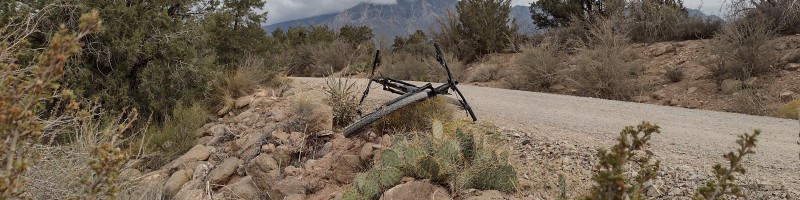
The first climb on this loop is enough to make you have the desire to turn back home, and it's less than a mile into the darn thing. Bailing on this steep road is always tempting, because all you have to do is turn around to be home in a few short, enjoyable minutes. If you decide to push through it, you'll find yourself a solid 2,500' above where we started. As you crest over the highest point of this climb, you will pass a point of difficult return. You've committed to a mile of downhill adventure and over a thousand feet of elevation loss (climbing back up this hill would really suck).
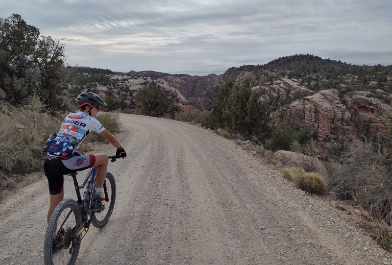
The next ten miles go by fast. It's mostly slightly downhill with a few small punchy climbs. I typically average 25-30mph in this section which means I usually pass a few minivans struggling over the ruts. Pass them with care because they probably won't hear or see you. After a creek crossing, we come up to the Yant Flat trailhead. This is where you will see the most vehicles over the entire loop. Yant Flat is a three mile out-and-back hike which overlooks the red cliffs reserve and the St. George valley. It is also known as candy cliffs for its beautiful swirling, rolling sandstone.
When riding in the spring, we cross another two creeks. Bitter Creek is the smallest of the two, while Cottonwood Creek typically requires a bike dismount if you wish to have a functional drivetrain. These creeks can be an awesome place to fill up on water. Make sure you top off north of the road to avoid contamination from heavy traffic.
The most notable part of this loop is on private land. It is a small orchard & grazing area known as Danish Ranch. The route passes right through a small grove of Oak Trees which protect about a hundred yards of cool air. In the late spring & early fall, this area becomes quite beautiful with lots of green, orange, and red color. Danish Ranch is also the end of your reward from the first climb. As soon as you come out of the greenery, you'll be met with the familiar hot air, coniferous trees, and steep climbs.
Most people consider this climb the hardest, but I disagree because it goes by quickly every time. Depending on your attitude, it's either a tough experience that will connect you with God, or a crappy climb that tries to give you heat stroke. The worst part about the second option, is that you can see the top of the climb the whole time. No matter how close you are to the top, it's always far away and higher than you.
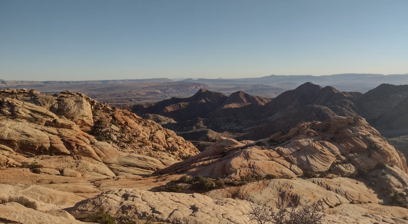
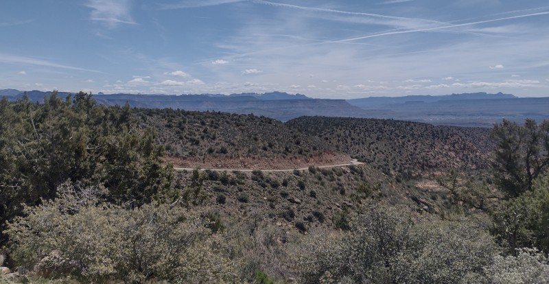
The summit of this climb is often mistaken for the highest point on this entire route but we already passed that shortly after Icehouse. I think this is due to this point having the best views. You can see the city of Hurricane, Toquerville, Leeds, Washington, and Saint George if you really squint your eyes. You can also see almost the entire turkey farm loop, starting from the water tower near Icehouse all the way over to the downhill coming into Leeds.
Speaking of the downhill coming into Leads, you'll want to take a break before you continue down it. I always bomb this, and you probably will too. Make sure you stretch, drink some water, and put your glasses back on (seriously, you'll regret it). Bonus points for doing some jumping jacks or something similar to loosen up. You're about to have the most fun two and a half miles of your life- assuming you opted for the mountain bike and not the gravel rig for this route.
Most of the downhill is over when you pass over a concrete bridge. At this point, you're officially in Leeds. It's all pavement from here, but still very fast pavement because we still have some elevation to lose over the next 20 miles. I spend almost all of the remainder of the route in my hardest gear, hands resting on the crown of my fork (or just on the drops for you gravel freaks) and mashing out at an easy 30-35mph.
There are a few options to get back home, and I might have lied about the pavement thing if you happen to be on a Mountain Bike. The most popular option is to go straight, and continue straight. You'll make it all the way back into town by staying on Old Highway 91/Telegraph. Some people also opt for continuing past Quail Creek Reservoir for a more scenic option. The third most popular option is to mountain bike the Prospector trail back to Washington via the Cottonwood Trailhead.
That's all! I will continue posting about more fun hike & bike routes over the next few months so keep posted if you'd like to hear about them.